15 Best Hikes in Canada
From the First Nation inhabitants and subsequently medieval Europeans, nature has been an inseparable part of every Canadian population throughout history. The landscape highlights dramatic sceneries and unique geographic phenomenons; Arctic winds from the northwest, towering summits of Yukon valley, countless lakes, rivers, and glaciers sheathed between the southern and northern ranges, and needless to say, the extraordinary Canadian wildlife.
Most hiking trails, including the groomed Nordic Trails, are safeguarded within the seven chief Canadian national parks. While the country ranks as a premium hiking and recreational activity destination, we have gathered a list of 15 Best Hikes in Canada.
1. Trans Canada Trail
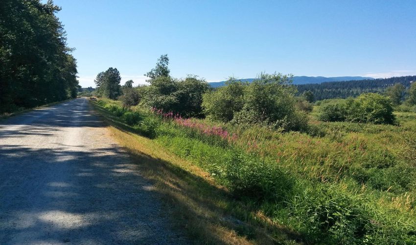
In 1992, the Canadian state constructed a national trail, as the country’s memorial of the 125th constitutional anniversary. Not only the longest of its kind across the country, but it is also one of the longest trails worldwide, which stretches over 24,000 kilometers.
It starts at Cape Spear on the east coast trail and connects many provinces east to west, and the north and Yukon valley; the altitude varies from sea-level Atlantic, Arctic, and Pacific marine landscapes to over 2000-meter-high summits, the footpath crosses both urban and natural gravitation.
The recreational trail comprises separate subroutes, suitable for motorbiking, hiking, snowshoeing, and skiing. From water gorges, woodland passages, and mountain passes, the trails lead the way to spectacular landscapes. The time required to slide, walk or ride across Trans Trail, is estimated for over two years, considering an average speed of 30 kilometers per day.
2. West Coast Trail
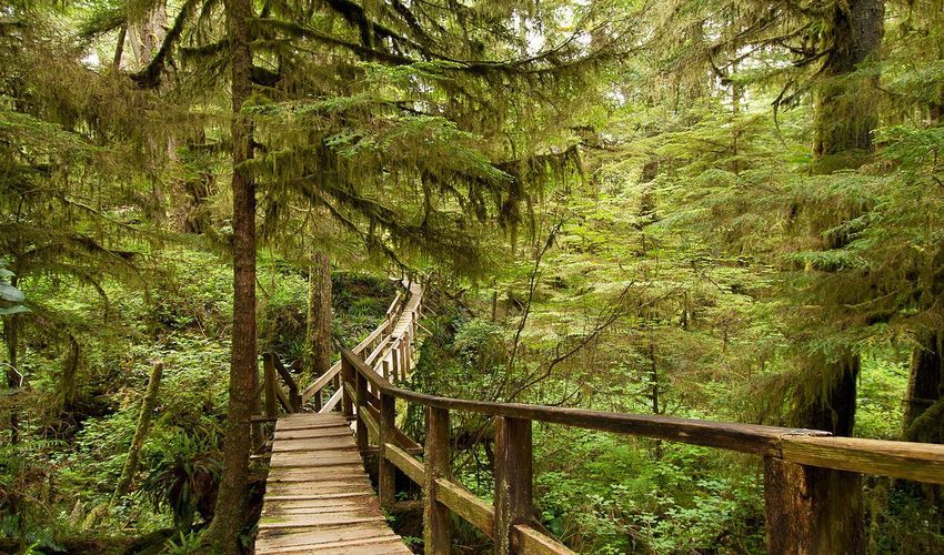
Located amid the wilderness of British Columbia’s Island, the fabled trails of Pacific Rim National Park Trails are among the most charming routes in Canada. Concealing over ten spectacular hikes, the region is known for its captivating beauty, and recreational activities including dog sledding, boulder climbing, and hiking down panoramic trails.
From the cragged cliff tops to the rain forest, sea caves, and sabulous coastlines, the West Coast trail challenges seasoned hikers to discover uncontaminated natural settings. Besides nature, the 72 kilometer-long stretch of West Coast Trail spans over the historic footpaths of the indigenous First Nation tribes.
3. Tamarack Trail
Where the meadows of Alberta province join the summits of the Canadian Rocky Ranges, lies the delightful hike of Tamarack, tucked in Waterton Lakes National Park. Once home to Niitsitapi mountain-dwelling tribes, the park still preserves partial footpaths dating back to 10,000 years ago. The captivating mountain setting, complemented with the cool breeze of snow-capped mountains and colossal glaciers, is often visited through summer months.
The surrounding biotope is noted for its rich diversity of animal and plant species and hence a favorite spot of wildlife sighting. Crown of the Continent Eco-Park and the glacier mark the national World Heritage site and located at a short hike from the national Trail of Tamarack.
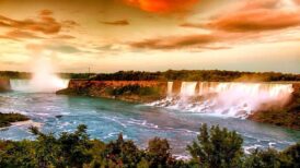
4. The Bruce Trail
The Bruce Trail is the most renowned trail of Canada, sweeping over 900 kilometers. The route starts at the World Heritage Site of Niagara Escarpment, crossing the majestic Niagara Falls. Several panels and detailed indications pinpoint the way through dense forests, lush meadows, outstanding townships.
Encircled with vineyards, some villages and towns have been inhabited since the First Nation tribes, hence leaving behind numerous heritage sites. Bruce Trail ultimately ends at Tobermory’s Marine Park and its crystalline shorelines. well-groomed trails, rest houses, and an eco-friendly network of routes that take the visitors into the wilderness of Canadian terrain.
5. Pingualuit Crater Hike
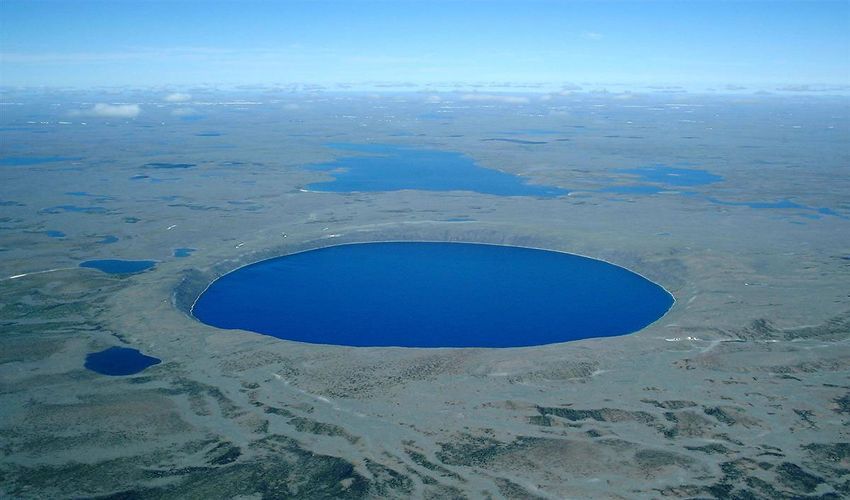
A 350-kilometer hike unveils the most of the natural and even celestial beauty of Quebec, in the Nord-du-Québec region. Groomed hiking and paddling trails run through Parc National des Pingualuit. Embodying most of the region, the park is home to the renowned Pingualuit Crater at Tundra. Residues of an ancient meteoroid indicate the origins of the crater, which is said to hold the world’s purest sweet water.
The hike takes over nine weeks to complete, characterized by delightful sceneries, crisp air, and sightings of the Nordic animal species. Rest houses on the pathway accommodate the visitors of the Nunavut region; often characteristic wooden cottages with basic and emergency amenities.
6. Chilkoot Trail
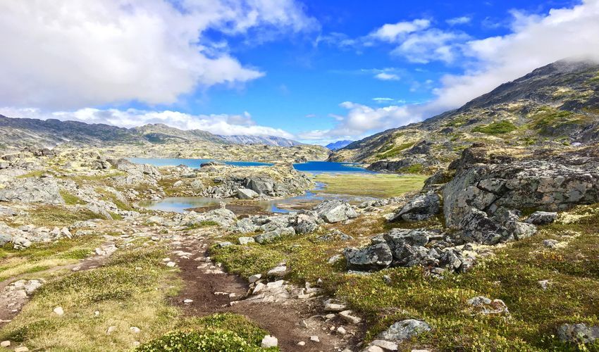
Coast mountains of southern British Columbia reach the ghost town of Dyea and the encircling Alaskan summits. The ancestral Alaskans, known as Tlingit First Nation Tribe, constructed a passage through the terrains of rock and ice, over 10,000 years ago. Later, the gold rush company used the route as an industrial transportation road in the 19th century.
Titled as Chilkoot Trail, today the ancient hike paves the way for the prospectors of Alaskan mountains while marking a national heritage. Stretching over 53 kilometers, the highest point lies at Chilkoot pass, with steep climbs that reward the climbers with astounding panoramic views at the Canadian and American borders.
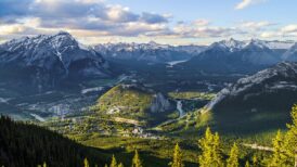
7. Johnston Canyon Trail
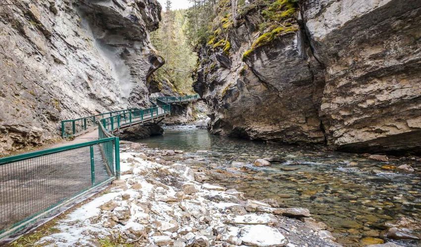
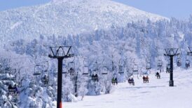
In Banff nature park, the Johnston Canyon trail is often frequented by families, nature enthusiasts and winter sports fans. Springs and summers are verdant and lush around Johnston creek, presetting a diverse flora and fauna and charming forest hikes. While the winters are characteristically cold and frozen, the canyon harbors recreational winter activities including; icefall climbing, snowshoeing, and winter sports workshops.
Titled as the Lower Falls, the hike from the large creek extends towards the Upper Falls. It ultimately joins the Ink Pots Trail.
8. Ink Pots Trail
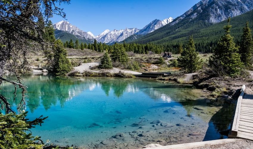
From Johnston’s upper falls, a delightful hike of three kilometers points the way to the ancient pools, each reflecting a different hue. The seven so-called Ink Pots, sit within a short distance on the highlands of Kootenay National Park.
As a result of sedimentation and oxidation of distinct minerals, these lakes indicate yellow, red, brown, and bluish-grey colors. The indigenous Ktunaxa used these minerals as coloring pigments, but today, these rare geographical phenomena stand as one most popular hiking destinations in the country.
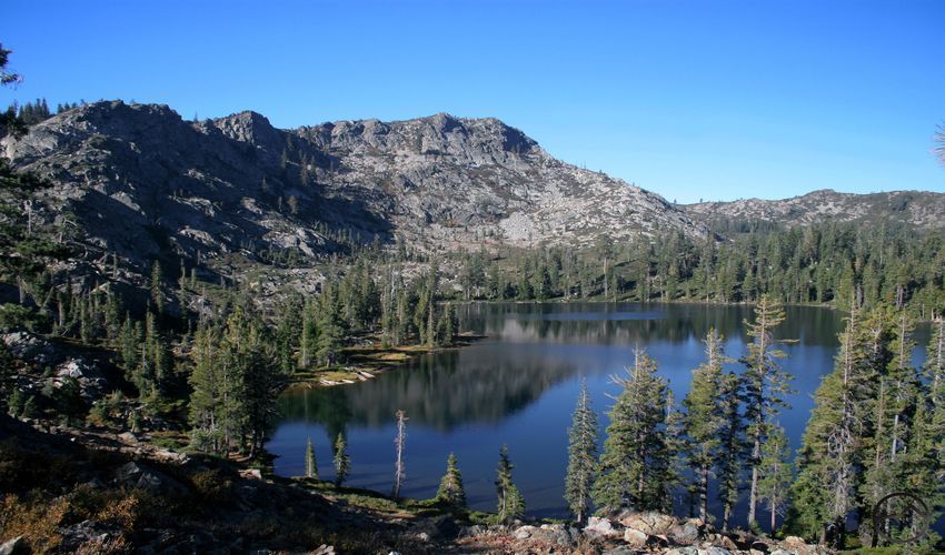
9. Skyline Trail
A 44-kilometer long loop trail circles around the heart of Jasper National Park in the Alberta region. The mile zero of the hike sits at proximity to the glacier lake of Maligne and ends at the park’s deepest ravine, Canyon of Maligne. Distinguished as a scenic hike of Canadian Rockies, it boasts from snow-capped mountain ranges, highland barren valleys with limitless horizons, sapphire lakes, falls and lagoons, and incredibly unique wildlife.
The park is home to a mostly Nordic variety of animal species; the majestic Canadian grizzly, black bear, and Nordic wolves and harmless species such as Elk and Bighorn sheep. The trails contain several signboards and campsites with cooking and basic accommodation facilities.
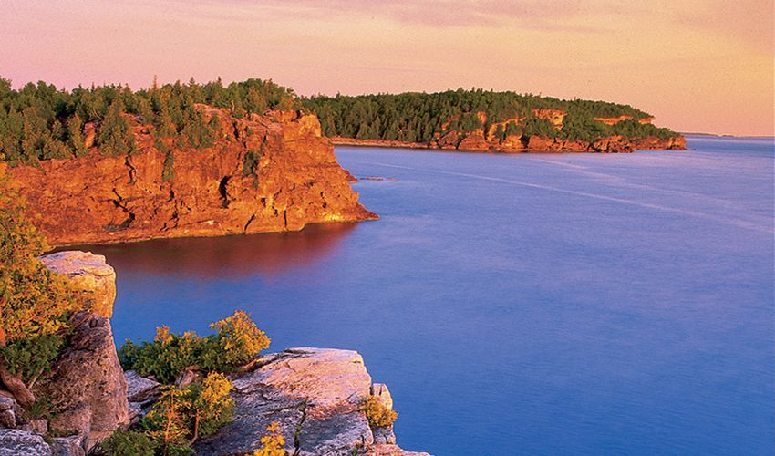
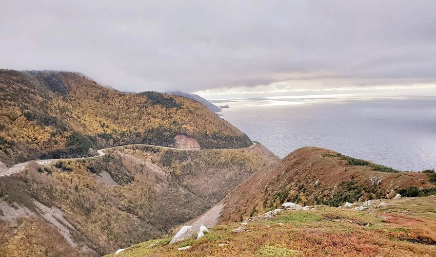
10. Coastal Hiking Trail
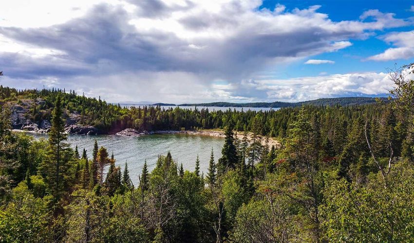
Situated at the heart of Pukaskwa National Reserve, the magnificent Coastal Hiking Trail encircles the Great Lake. It is a walk of 60 kilometers, featuring emerald waters, pebbled beaches, cragged cliffs, and rich vegetation of wetland and forests. Besides hiking down the steep passage and enjoying the lakeside promenade, Coastal Hikes offer a particular nature; discovering the tucked-away coves amid the cragged coastlines, foraging wild berries, and sighting the country’s national animal, the Canadian moose.
Scattered marshlands next to the Great Lakehouse exotic numerous aquatic bird species. Each year, hundreds of photographs and wildlife admirers are lured to such assemblage of natural beauty here, in the largest national park of Ontario.
11. Fundy National Park
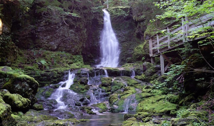
The rugged shorelines of Fundy Bay have gained international popularity for its remarkable land space, vistas of Point Wolfe River, and the world’s highest tides. Fundy National Park encompasses the bay and its surrounding nature and wildlife, veined with over 100 kilometers of groomed hiking trails.
Fundy Circuit marks the largest hiking trail of this nature reserve, that stretches over 50 kilometers of upland forests, steep cliff hikes, and moss-ridden forests located in the depth of river ravines. Circuit of Moosehorn and Laverty Falls, Goose River route, and Upper Salmon Trail are among other notable hikes of the region.
12. La Cloche Silhouette Trail
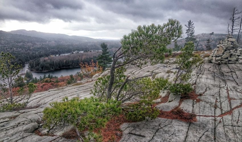
Killarney Provincial Park sits on the northern terrain of Ontario and is ringed by La Cloche Mountains. A hand-curated stretch of 80 kilometers divides the trails of Killarney Nature Park into five sections; Beaver inhabiting forests of Baie Fine, cedar forests of Threenarrows Lake, strenuous mountain hike of Hansen, the highland passage of Silver Peak with panoramic vistas, and an exceptional passage- a narrow gorge titled as the Crack.
It is mentionable that the trail, La Cloche Silhouette, is named after an artistic impression by Franklin Carmichael.
13. Berg Lake Trail
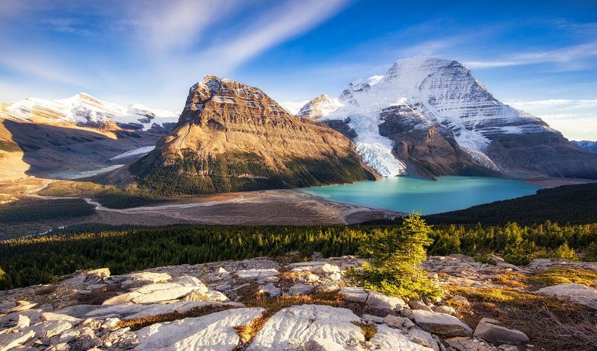
Encircled by the bold summits of Berg, Robson, and Mist, the Berg Lake Trail holds international significance among the hiking community. The twenty-three-kilometer long hike spans across many water bodies; streams, waterfalls, and lakes, fed by nearby glaciers. The route starts at the sapphire Lake of Kinney and continues to the Valley of a Thousand Waterfalls; a colossal canyon overflowing with countless waterfalls from each side.
At the vicinity of Berg’s glacier lake, a campsite with adequate facilities. The entire trail is dotted with campgrounds, reaching a total of seven clusters of tent pads, water, and food storage, and basic sanitary amenities. The most scenic campsite sits between the limits of Jasper National Park and Mount Robson Nature Reserve. Enclosed by the cragged beauty of mount Berg, the campsite overlooks the lake, the glacier river, and breathtaking panoramic views of the waterfall canyon.
14. Plain of Six Glacier Trail
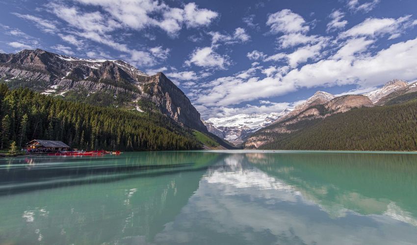
Highlighting Canada’s most touristic hike at Plain of Six Glaciers, streams of melted ice that overflow steep cliffs, forming breathtaking waterfalls. Exceptional wildlife, bewitching backdrop, and the undemanding hike have turned this trail to the most photographed Canadian hiking route.
The pool of Tenaya Creek, known as Mirror Pool, lounges paces from the Glacier Trail. Since sitting on the quieter side of the glacier terrain, it is relatively easy to spot interesting native animals around the creek.
15. Canol Heritage Trail
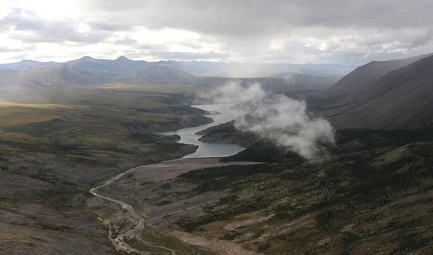
While the Chilkoot Trail counts among Canada’s difficult trails, the most challenging hiking route of Canada prevails at the heart of the Northwest region, known as Canol Heritage Trail. It runs across 350 kilometers, starting at the petroleum town of Norman Wells. The passage divides the high lands of Mackenzie Ranges and Macmillan Pass, reaching the boundaries of Yukon. Unlike the traditional Canadian hiking, Canol Heritage Trail resembles the most Himalayan hikes in many facets.
Except for natural shelters found in the icy territory, rugged mountains, and narrow and steep passage, there are no campgrounds or hiking facilities. Hikers require carrying their basic prerequisites for a 22-day journey through the absolute wilderness; food, sleeping bag and tent, water purifier, an emergency kit, fire starter, and basic cooking gears-only to name a few of must-have camping gear.
While Banff National Park, its spectacular hikes, and panoramic viewpoints are eminent across the globe, the beauty of Nahanni National Park Reserve remains rather under-discovered. The entire Northwest sprawls on the highest summits of the country, largest glaciers, and epic scenery consequent to extreme weather conditions. The most drastic landscape of Canada is found in the Canyon of Scimitar. It is regarded as one of the most dangerous places on earth with profound fissures.
Another notable destination in this reserve is the Fairy Meadow, revealing broad highland pastures and wildflower beds and encircling gallant peaks- once used as a cattle pasture by indigenous Yellowknife tribes. A hand-built network of passages connected the pastures, mountain passes, and villages of the ancient residence; regarded as UNESCO Heritage Site and a national treasure. Several hikes run through this region, and most intersect with the unique Network of Ice Highway of Northwest, built on a series of frozen lakes.